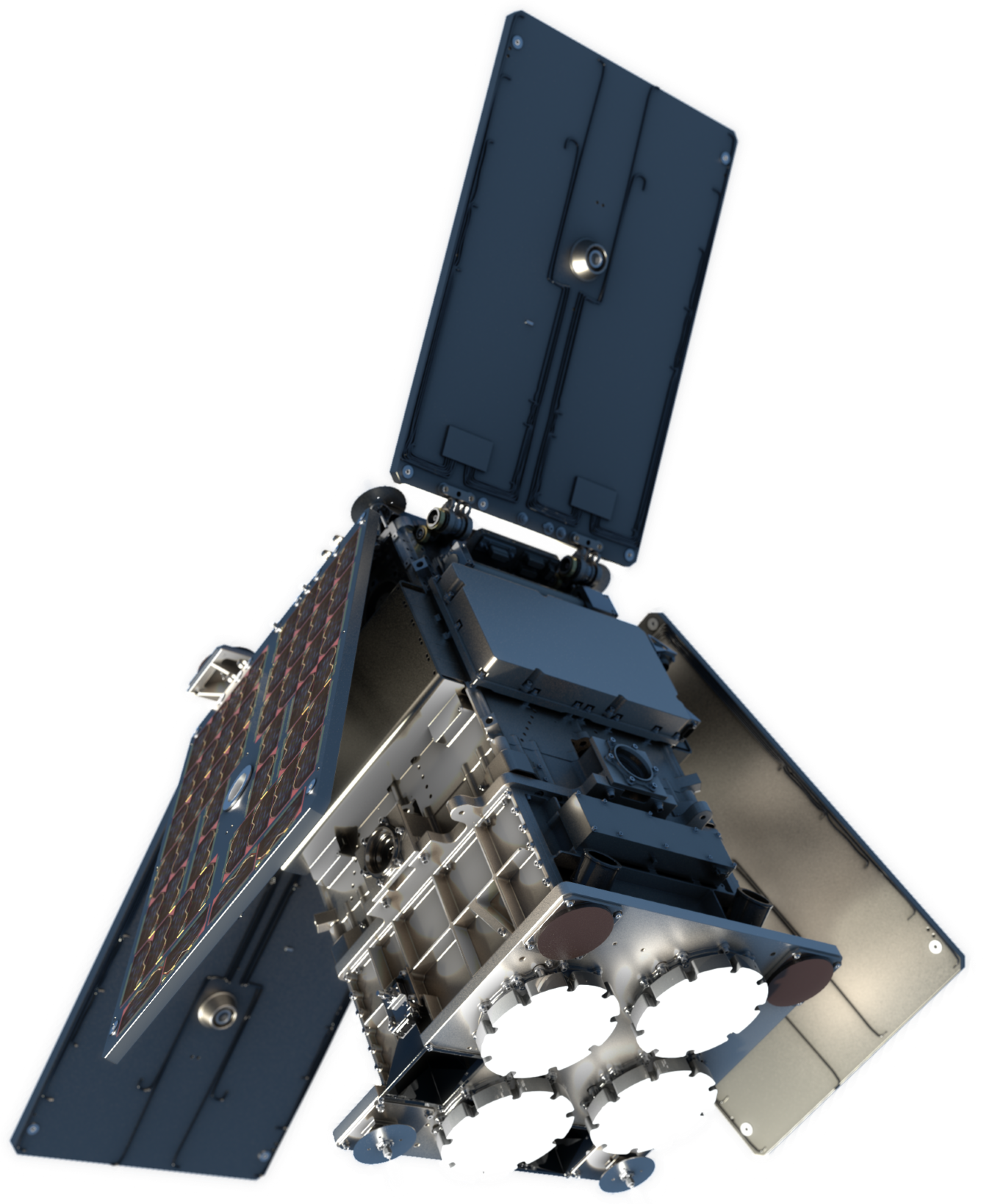
The HydroGNSS Scout mission comprises of two small satellites in Low Earth Orbit that sense global hydrological climate variables using GNSS Reflectometry.
The Scout programme is a new small satellite initiative in the European Space Agency's FutureEO Earth Science programme, tapping into the New Space ethos to achieve scientific advances with a small budget and rapid schedule. HydroGNSS is one of the first two Scout missions, and was approved in 2021.
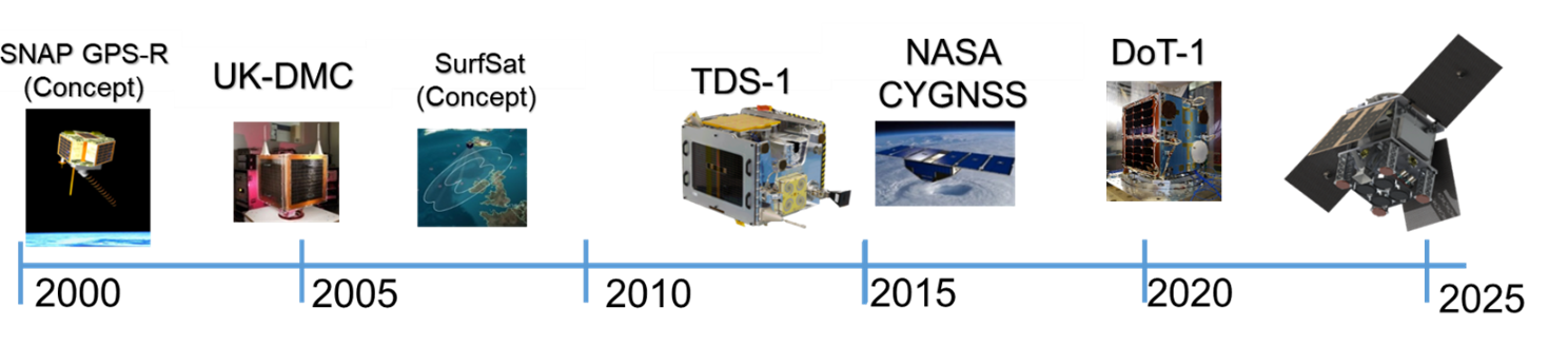
GNSS Reflectometry (GNSS-R) is the opportunistic use of Global Navigation Satellite System signals (such as from GPS and Galileo) as bistatic radar sources for sensing the characteristics of the reflecting surface. Microwave signals at L-band frequency are continually broadcast from dozens of GNSS satellites Medium Earth Orbit (MEO) altitudes and multiple reflections can be collected simultaneously from Low Earth Orbit (LEO) by a small satellite, and it has been shown these reflections contain the imprint of the reflecting surface. At the L-Band microwave frequency, signals are little affected by clouds, rain and weather conditions, and signals have better vegetation and soil penetration than higher frequency radar. HydroGNSS builds upon earlier spaceborne GNSS-R missions UK-DMC, TDS-1 and CYGNSS that showed the potential of GNSS-R for sensing geophysical parameters over the ocean, ice and land.
Water is a natural resource vital to climate, weather, and life on Earth, and unforeseen global variability in hydrological cycle poses one of the greatest threats to the world's population. Scientists, meteorologists and others use global soil moisture measurements from space for accurate weather forecasting, flood warning services, agriculture, subsidence, permafrost sensing, and climate modelling.
HydroGNSS takes measurements over the land closely linked to Essential Climate Variables (ECVs) defined by the Global Climate Observing System (GCOS) for addressing climate related issues. These are soil moisture, freeze/thaw state over permafrost, inundation and wetland extent, and above ground forest biomass. Over the ocean, HydroGNSS will take secondary measurements of ocean wind speed and sea ice extent.